Dalton Highway
The Dalton Highway (also called the Haul Road) branches off the Elliott Highway near Livengood, Alaska, just over 70 miles north of Fairbanks. It then proceeds 414 miles north to the oil fields of the North Slope. The Dalton has fewer services and improvements than other roads in Alaska (which isn't much to begin with) and is not for the unprepared. See my Alaska reference map.
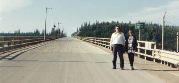
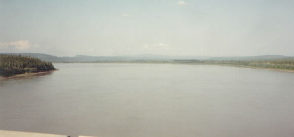
One of the first landmarks on the Dalton is the Yukon River at 56 mile. With headwaters in Canada and the mouth opening into the Bering Sea, the mighty Yukon cuts Alaska in half and opens up many Alaskan communities to river commerce during the fleeting summer months.
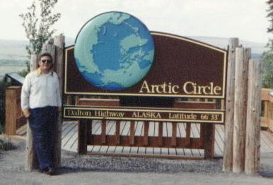
The Dalton Highway is the only road in Alaska that crosses the Arctic Circle. You have to brave 115 miles of the Dalton and 30 plus miles of the Elliott (all unpaved) to reach this point.
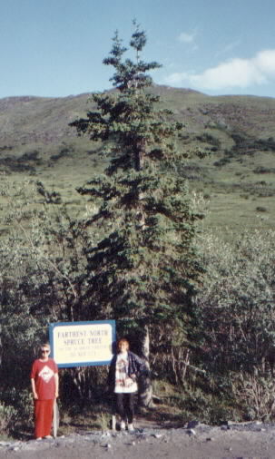
As you proceed north, you reach the northern tree line. This northern limit is not set by altitude, but rather by the extreme latitude. Alyeska pipeline company have a proud sign showing the farthest north tree on the pipeline system.
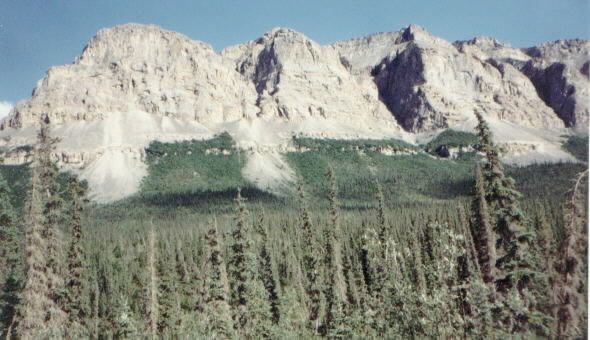
The northern tree line brings the impressive Brooks Range, the northernmost range in Alaska. This range separates the Yukon River drainage from the Arctic Ocean drainage system.
More Dalton Highway
Back to Alaska Photo Index